Synthetic Aperture Radar Interferometry: Theory and Practice
Instructors: Dr. Chayma Chaabani, Pr. Saeid Homayouni
Description: Synthetic Aperture Radar (SAR) imagery is a powerful tool for continuous Earth surface monitoring, operating day and night regardless of weather conditions. The Interferometric SAR (InSAR) technique, based on the principles of radar interferometry, employs radar waves to measure the ground surface topography and deformation. This involves considering the phase differences between radar signals collected during multiple passes over the same geographical area at different times.
This workshop aims to provide participants with an understanding of InSAR’s key concepts and possible applications across various remote sensing disciplines. Throughout the workshop, participants will explore various acquisition modes employed in InSAR data, focusing on freely available Sentinel-1 sensor imagery. The workflow process of generating InSAR products will be introduced, including InSAR coherence and interferogram. Moreover, the participants will be able to gain insight into interpreting InSAR products in different applications. Participants will also learn about using InSAR to monitor natural hazards and explore its role in tracking the changes in the ground surface and topography.
Furthermore, the workshop will allow participants to work on a real-case application. They will use the open-source Sentinel-1 dataset and ESA SNAP software to investigate a study case of ground surface deformation monitoring by combining theoretical knowledge with practical learning. This interactive practical session will provide participants with experience generating the InSAR products to perform soil deformation monitoring applications.
Requirements
- Basic SAR knowledge is required
- Participants will need laptops and the open-source ESA SNAP software installed (https://step.esa.int/main/download/snap-download/)
Dr. Chayma Chaabani holds an engineering degree in computer science from the National School of Computer Science (ENSI), Tunisia, and a Ph.D. diploma in Information and Communication Technologies (ICT) from the Higher School of Communication of Tunis (SUPCOM), Tunisia. Since July 2022, she has been a postdoctoral fellow in the Northern and Environmental Remote Sensing (TENOR) laboratory at the Centre for Water, Land, and Environment of the Institut National de la Recherche Scientifique (INRS-ETE) in Quebec, Canada. Her research primarily centers on utilizing and analyzing SAR and InSAR techniques for ice monitoring and ground motion using machine learning and deep learning approaches.

Pr. Saeid Homayouni is a professor of environmental remote sensing and geomatics at the Centre for Water, Land, and Environment of the Institut National de la Recherche Scientifique de Quebec (INRS-ETE). He leads the Group on Earth Observation Analytics by Artificial Intelligence (GEO-AI) at the INRS-ETE and co-lead the Northern and Environmental Remote Sensing Laboratory (TENOR). Given his expertise in environmental remote sensing and geomatics, his research mainly focuses on analyzing Big Earth observations (Optical, Hyperspectral, SAR, and UAV imageries) using advanced machine learning and artificial intelligence techniques for urban and agro-environmental applications such as mapping and monitoring croplands, wetlands, coastal and sea ice, and landslides.
Demystifying Microwave (Especially Synthetic Aperture Radar) Remote Sensing: A Course for Everyone!
Instructor: Sarah Banks
Description: This half-day course is designed to help students and professionals alike understand some of the most complex concepts in SAR remote sensing. Made for everyone from complete beginners to advanced users, NO prior knowledge about SAR, linear algebra, physics, or remote sensing is required! Using practical examples and simple visualizations, this comprehensive course answers questions like what is polarization and phase? What is a complex number? What target characteristics affect incident microwaves and why? In a hands-on lab exercise we also demonstrate where and how to download SAR imagery. We examine the contents of a raw SAR image, learn how to open, visualize and apply pre-processing in SNAP.
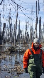
Sarah Banks is a Physical Scientist at Environment and Climate Change Canada, as well as a PhD student in Geography and Environmental Studies at Carleton University.
I grew up in a small town about an hour south of Ottawa where, as a kid, I used to spend my summers either playing Nintendo or exploring the forests and wetlands in my neighborhood. I think that’s how I became interested in Geography. When I left for university I planned on becoming a Geography teacher, though after taking a few courses I became more interested in remote sensing, and eventually pursued a Bachelor’s, then a Master’s degree in Physical Geography at Carleton. It was during my Master’s that I also became interested in Synthetic Aperture Radar (SAR) as I used it both at work as a Research Affiliate Program student at Agriculture and Agri-Food Canada as well as for my Master’s thesis project, which focused on mapping shoreline types. I continued working with SAR after I graduated while working as a visiting research scientist at the German Aerospace Centre, then as a physical scientist at Environment and Climate Change Canada. Throughout my career I have been passionate about promoting diversity equity and inclusion in remote sensing, especially SAR remote sensing, so in 2020 myself, Dr. Laura Dingle Robertson, and Dr. Gopika Suresh started the X (twitter) account @sistersofSAR to share the exceptional advancements and research attributable to #WomeninSAR. Throughout my career I have also had a passion for teaching SAR in a way that makes it easy to understand, making it more accessible to a wider audience of scientists and other end-users. Because of this, I have taught SAR courses at the college and university level, and for NASA’s ARSET program.
LidR – The Free and Open LiDAR Package in R.
Instructors: Hana Travers-Smith, Claire Armour, Leanna Stackhouse, UBC Integrated Remote Sensing Studio Faculty of Forestry
Description: This workshop is all about unlocking the power of the lidR package for forest management. Attendees will learn how to access and analyze information from lidar files, including how to select regions of interest and generate standard products like digital terrain models and canopy height models. The workshop will also cover topics such as how to use lidR outputs for forest attribute modeling using the area-based approach, individual tree segmentation, and creating user-defined metrics. Participants will discover how to efficiently process collections of lidar files using the lascatalog processing engine. Don’t miss out on this opportunity to take your lidar analysis skills to the next level!

Hana Travers-Smith
UBC Integrated Remote Sensing Studio Faculty of Forestry
Claire Armour
UBC Integrated Remote Sensing Studio Faculty of Forestry
Leanna Stackhouse
UBC Integrated Remote Sensing Studio Faculty of Forestry
Deep Learning for Remote Sensing
Instructor: Maryam Jameela
Description: Multiple areas of science have tried to understand or mimic the human brain’s behaviour to develop solutions to facilitate environmental, military, and civil applications. Deep learning became one of the fastest-growing areas of machine learning which attempts to classify, detect, segment, and recognize objects and areas of interest through a neural network like neurons. Therefore, deep learning can be used for various autonomous navigation and remote sensing applications and has gained great success in the past decade. In the remote sensing community, deep learning has been applied to multiple data types (e.g., spectral, hyperspectral, LiDAR) for the applications of classification, anomaly detection, terrain surface classification, object detection, and many more.
Deep learning attempts to mimic the human brain to learn to understand the given information, called a training pool. The training pool is a large amount of labelled data that teaches deep learning model high- and low-level features. Subsequently, the trained model is used at the inference stage to predict unseen datasets. The deep learning model is also referred to as a backbox because it provides an end-to-end solution for tasks that traditionally require user supervision.
Our workshop will introduce deep learning approaches through theory and examples. It will include two sessions; the first will focus on image datasets (2D), and the second will focus on LiDAR datasets (3D).
The first session will overview deep learning, explaining important theories and terminologies in convolutional neural networks. Following this, we will review the latest 2D object detection network such as Oriented RCNN which will be the focus of this session’s demonstration for detecting pylon and span in utility corridor data. The second session will cover a lecture that discusses LiDAR point-cloud processing. We will be reviewing RandLA and SUNet to understand the demonstration of urban scene understanding and semantic segmentation of utility corridors.
Requirements:
- Basic knowledge of programming
- Laptop is required
- A Github account is optional

Maryam Jameela is a Ph.D. from the Department of Earth and Space Sciences and Engineering at Lassonde School of Engineering, York University. She works as a Research Scientist at Teledyne Optech, Canada. Her current research work is a collaboration between the Mobility Innovation Centre (MOVE) at the Lassonde School of Engineering, York University, and Teledyne Optech. The major research focus was developing a noise-filtering deep neural network and deep utility semantic neural network for the large-scale 3D point cloud. She has experience of 06 years in geomatics and deep learning and, overall, 10 years of experience in software development.
Surface Water and Ocean Topography (SWOT)
Instructors: Mélanie Trudel, Samuel Foucher, Université de Sherbrooke ; Gabriela Siles, Université Laval
Description: The purpose of the workshop is to familiarize participants with the newly launched Surface Water and Ocean Topography (SWOT) Satellite.
The SWOT mission, led by the National Aeronautics and Space Administration (NASA) and the Centre national d’études spatiales (CNES), in collaboration with the Canadian (CSA) and UK (UKSA) space agencies, includes a new altimetry sensor concept representing a major advance over existing sensors. The SWOT satellite’s main sensor (KaRin) is a Ka-band radar interferometer (8.6 mm) at near nadir (0.6° to 3.9°). This maximizes the signal over water (backscatter of the order of 20 dB over water). The satellite provides global inventory and water level measurements for lakes, reservoirs and wetlands larger than 250m x 250m, as well as for rivers wider than 100m.
To inform the remote sensing community in adopting the use of SWOT data products in their research and management of water (including snow and ice), the following will be covered:
- Description of the SWOT satellite mission
- Description of SWOT data products (SLC, PIXC, Raster, LakeSP, RiverSP) and of how to access and read SWOT products
- Illustration of SWOT data products usage in hydrological and water resources research and monitoring
- Discussion of the challenges in using the SWOT products
Requirements:
- Basic knowledge of programming is desirable (esp. Python)
- Participants will need to bring their own laptop (QGIS last version installed).
Mélanie Trudel has been a professor in the Department of Civil and Building Engineering at the Université de Sherbrooke since 2017. She is an expert in radar remote sensing (SWOT and C-band), hydrodynamic and hydrological modeling. As a member of the SWOT science team, she has been involved in the SWOT program since 2016 through her collaborations with teams at LEGOS and CNES (France), as well as with the Canadian Space Agency and Environment and Climate Change Canada.
Gabriela Siles is a professor at the Department of Geomatics of the Université Laval since 2023. She is a geodesist with expertise in radar and optical remote sensing including altimetry for freshwater environments. She has been involved in the SWOT project since 2018 and she is part of the international and the Canadian SWOT scientific team. She closely works with the SWOT algorithm development team from the CNES and with LEGOS (France). Her activities include SWOT Cal/Val and science field activities in southern Quebec. She also collaborates with the Canadian Space Agency and Environment and Climate Change Canada in the framework of the SWOT mission.

Samuel Foucher is a professor in the Department of Applied Geomatics at the Université de Sherbrooke in Quebec, Canada. He holds a PhD in remote sensing from the same university. He has over 25 years of research and development experience in industry across different application domains. His main areas of expertise are scientific platforms for big Earth observation data exploitation and the application of deep learning to environmental sciences. His research interests include remote sensing, synthetic aperture radar, deep learning, image denoising, climate change, image processing, and SAR polarimetry.
Google Earth Engine
Instructors: Nick Pontone, Yasaman Amini, Carleton University
Description: Discover the environmental analysis with our Google Earth Engine (GEE) workshop, where the complexity of satellite data becomes accessible and engaging. GEE is a powerful, free, and cloud-based platform that facilitates the analysis of time series and big data from remotely sensed imagery without the need for specialized software or local data storage and processing. It provides direct access to extensive satellite archives, including, but not limited to, MODIS, Landsat, and Sentinel, through Python or JavaScript APIs.
This workshop is designed to provide an exploration of Earth Engine’s capabilities using Python API to enable wide-area and time series analysis of multi-spectral and SAR imagery. It will incorporate a blend of hands-on exercises, practical demonstrations, and lectures that cover both technical and theoretical aspects of remote sensing. Topics of focus will include the analysis of water extents for flood mapping, land-use classification, and time series data extraction.
This course is ideal for GIS enthusiasts, environmental scientists, and anyone interested in Earth observation, offering a straightforward path to leveraging cloud computing in their workflows. Participants should be willing to learn some basic coding skills. While prior coding experience is not a prerequisite for this course, a foundational understanding of scripting languages will be beneficial.
Requirements:
- Participants are required to bring their own laptop,
- have a Google account (e.g. a Gmail account), and
- should apply for access to the Google Earth Engine platform prior to the workshop by filling out the form at https://signup.earthengine.google.com .
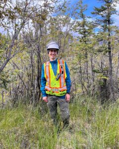
Nick Pontone is a PhD student under the supervision of Dr. Koreen Millard in the Department of Geography and Environmental Studies at Carleton University. His research focuses on the remote sensing of boreal peatlands using big data, multi-sensor, machine learning, and time-series analysis techniques. Nick has been using GEE for a number of years, and uses both the JavaScript and Python API for image pre-processing and analysis.
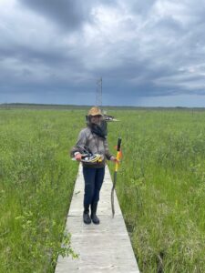
Yasaman Amini, currently pursuing her PhD at Carleton University within the Department of Geography and Environmental Studies, collaborates closely with Dr. Koreen Millard and Dr. Murray Richardson. Her research focuses on improving the predictive capabilities of wildfires in peatlands, using remote sensing technologies. Yasaman is skilled in using GEE for analyzing environmental data, which helps in a deeper understanding of hydrology and vegetation dynamics.

